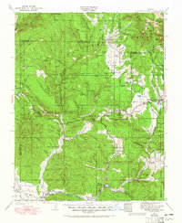
1924 Map of Pagosa Springs
USGS Topo · Published 1965About this map
Pagosa Springs serves as the regional hub in this mid-1920s survey, situated where the Pagosa River meets the local road network. The landscape is defined by the sharp transition between the high peaks of the San Juan National Forest, such as Pagoda Peak and Eagle Mtn, and the southern river valleys. Life in these basins is anchored by rural infrastructure, including the Stollsteimer School, Yellowjacket School, and Bayles School. To the south, the Denver and Rio Grande Western railroad follows the winding path of the San Juan River, connecting remote settlements like Juanita and Pagosa Junction. This era of the region is characterized by a managed wilderness, where the Southern Ute Indian Reservation and Ute Ceded Land borders meet early forest service outposts like the Yellowjacket Ranger Station.
Find a feature on this map
108 named features on this map. Tap any name to fly to it.
Don’t see what you’re looking for? This feature index may not catch every label — zoom into the map to look around manually.
Map Details
Editions of this 1924 Pagosa Springs Map
2 editions found

Other maps of this area

1889 · Largo
USGS Topo · 1:250,000

1895 · Largo
USGS Topo · 1:250,000

1900 · Needle Mountains
USGS Topo · 1:62,500

1902 · Needle Mountains
USGS Topo · 1:62,500

1905 · San Cristobal
USGS Topo · 1:125,000

1907 · San Cristobal
USGS Topo · 1:125,000

1908 · Ignacio
USGS Topo · 1:125,000

1913 · Summitville
USGS Topo · 1:125,000

1914 · Creede
USGS Topo · 1:125,000

1915 · Summitville
USGS Topo · 1:125,000