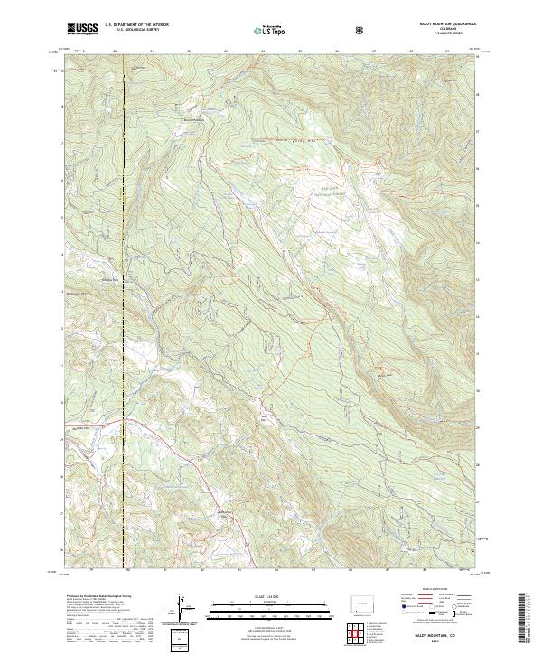
2023 Map of Baldy Mountain
USGS Topo · Published 2023About this map
San Juan National Forest covers much of this high-elevation landscape along the boundary between La Plata and Archuleta counties. The area is defined by a dense network of forest trails and water management features, including Hayden Reservoir Number 1 and Dry Lake Reservoir. Local settlement history is centered on Ute Park, while the rugged geography is marked by landmarks such as Baldy Mtn and Indian Mtn.
Find a feature on this map
109 named features on this map. Tap any name to fly to it.
Don’t see what you’re looking for? This feature index may not catch every label — zoom into the map to look around manually.
Map Details
Editions of this 2023 Baldy Mountain Map
This is the sole edition of this map. No revisions or reprints were ever made.
Other maps of this area

1908 · Ignacio
USGS Topo · 1:125,000

1924 · Ignacio
USGS Topo · 1:125,000

1924 · Pagosa Springs
USGS Topo · 1:125,000

1927 · Pagosa Springs
USGS Topo · 1:125,000

1945 · Durango
USGS Topo · 1:250,000

1953 · Durango
USGS Topo · 1:250,000

1954 · Durango
USGS Topo · 1:250,000

1961 · Durango
USGS Topo · 1:250,000

1963 · Durango
USGS Topo · 1:250,000
1964 · Devil Mountain
USGS Topo · 1:24,000