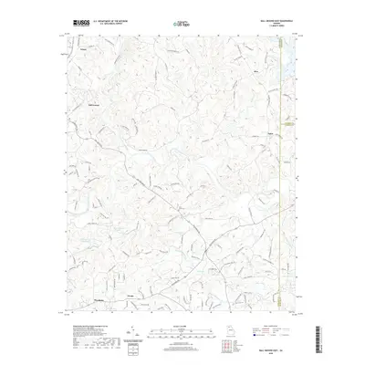
2020 Map of Ball Ground East
USGS Topo · Published 2020About this map
The Etowah River carves a central path through this portion of the Georgia Piedmont, serving as a primary drainage for a network of winding creeks including Conn Cr and Smithwick Cr. The landscape is defined by the rural corridors connecting several small communities, with Ball Ground and Nelson positioned in the northwest and Macedonia and Orange anchoring the southwest. This area preserves traces of earlier transportation and industry, most notably the Old Federal Rd and the Cherokee Gold Trl, which reflect the region's complex 19th-century history of migration and mining.
Find a feature on this map
131 named features on this map. Tap any name to fly to it.
Don’t see what you’re looking for? This feature index may not catch every label — zoom into the map to look around manually.
Map Details
Editions of this 2020 Ball Ground East Map
This is the sole edition of this map. No revisions or reprints were ever made.
Other maps of this area

1890 · Suwanee
USGS Topo · 1:125,000

1894 · Suwanee
USGS Topo · 1:125,000

1926 · Tate
USGS Topo · 1:62,500

1928 · Tate
USGS Topo · 1:62,500

1955 · Rome
USGS Topo · 1:250,000

1956 · Birmingham
USGS Topo · 1:24,000

1958 · Rome
USGS Topo · 1:250,000

1961 · Rome
USGS Topo · 1:250,000
1961 · Canton
USGS Topo · 1:24,000

1963 · Rome
USGS Topo · 1:250,000