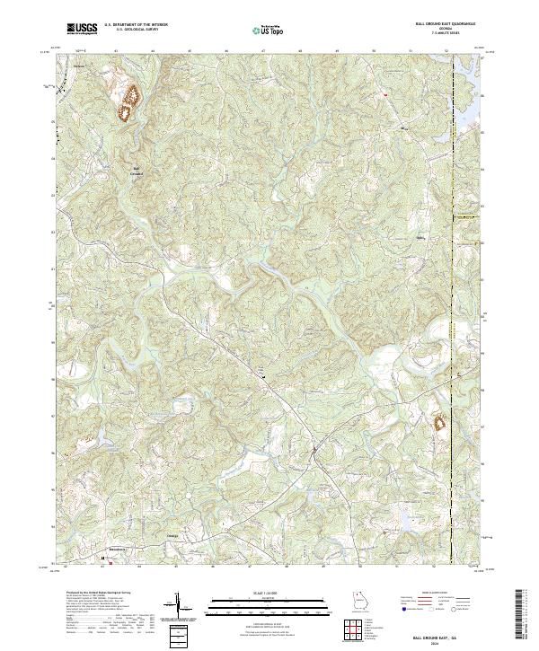
2024 Map of Ball Ground East
USGS Topo · Published 2024About this map
Ball Ground sits at the heart of this landscape, where the Etowah River carves a winding path through the borderlands of Cherokee, Dawson, and Forsyth counties. The terrain is defined by a dense network of watercourses, including Long Swamp Creek and Yellow Creek, which have historically shaped the settlement patterns of rural communities like Mica, Ophir, and Orange. Significant local history is anchored at the Cane Creek Cem and Canton Cem, while the presence of the Cherokee Gold Trl and Old Federal Rd points to the area's deeper heritage of migration and early commerce. The modern geography is also shaped by numerous small reservoirs such as Bartholomew Lake and Dean Lake, reflecting the shift from purely agricultural use to more managed water resources in this portion of north Georgia.
Find a feature on this map
131 named features on this map. Tap any name to fly to it.
Don’t see what you’re looking for? This feature index may not catch every label — zoom into the map to look around manually.
Map Details
Editions of this 2024 Ball Ground East Map
This is the sole edition of this map. No revisions or reprints were ever made.
Other maps of this area

1890 · Suwanee
USGS Topo · 1:125,000

1894 · Suwanee
USGS Topo · 1:125,000

1926 · Tate
USGS Topo · 1:62,500

1928 · Tate
USGS Topo · 1:62,500

1955 · Rome
USGS Topo · 1:250,000

1956 · Birmingham
USGS Topo · 1:24,000

1958 · Rome
USGS Topo · 1:250,000

1961 · Rome
USGS Topo · 1:250,000
1961 · Canton
USGS Topo · 1:24,000

1963 · Rome
USGS Topo · 1:250,000