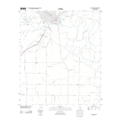
2012 Map of Ballinger
USGS Topo · Published 2012About this map
The Colorado River defines the southern edge of Ballinger, where a dense grid of streets like Sealy Ave and Railroad Ave meets the water’s edge. This landscape is characterized by a network of drainage creeks and tributaries, including Elm Cr, Sand Br, and Stag Br, that flow through the surrounding plains of Runnels County. To the west, the Los Arroyos terrain sits near Country Club Lake, while the local infrastructure is supported by Bruce Field Airport to the southwest.
Find a feature on this map
89 named features on this map. Tap any name to fly to it.
Don’t see what you’re looking for? This feature index may not catch every label — zoom into the map to look around manually.
Map Details
Editions of this 2012 Ballinger Map
This is the sole edition of this map. No revisions or reprints were ever made.
Other maps of this area

1891 · Hayrick
USGS Topo · 1:125,000

1892 · Ballinger
USGS Topo · 1:125,000

1894 · Hayrick
USGS Topo · 1:125,000

1921 · Hatchel
USGS Topo · 1:31,680

1921 · Lowake
USGS Topo · 1:31,680

1921 · Quarry Creek
USGS Topo · 1:31,680

1921 · Spur Creek
USGS Topo · 1:31,680

1921 · Rowena
USGS Topo · 1:31,680

1925 · Ballinger 3-d
USGS Topo · 1:48,000

1932 · Paint Rock
USGS Topo · 1:62,500