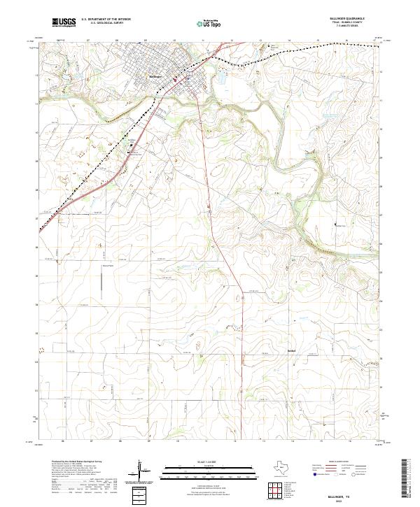
2022 Map of Ballinger
USGS Topo · Published 2022About this map
The Colorado River defines the landscape as it winds past Ballinger, serving as the geographical anchor for this Central Texas region. The town is laid out on a grid north of the river, with the Runnels County Courthouse serving as its civic heart and Bruce Field situated to the southwest. This modern survey illustrates the proximity of agricultural land to the developed municipal center, showing the road network extending into the rural community of Bethel. Several burial sites are documented across the quadrangle, including Latin American Cem, Evergreen Cem, and Walthall Cem, providing important landmarks for family historians and genealogists. Water resources are prominent throughout the area, from the larger flow of the Colorado River to smaller drainages like Pony Cr, Stag Br, and Sand Br, which feed into the primary river system alongside Country Club Lake and Lee Lake.
Find a feature on this map
102 named features on this map. Tap any name to fly to it.
Don’t see what you’re looking for? This feature index may not catch every label — zoom into the map to look around manually.
Map Details
Editions of this 2022 Ballinger Map
This is the sole edition of this map. No revisions or reprints were ever made.
Other maps of this area

1891 · Hayrick
USGS Topo · 1:125,000

1892 · Ballinger
USGS Topo · 1:125,000

1894 · Hayrick
USGS Topo · 1:125,000

1921 · Hatchel
USGS Topo · 1:31,680

1921 · Lowake
USGS Topo · 1:31,680

1921 · Quarry Creek
USGS Topo · 1:31,680

1921 · Spur Creek
USGS Topo · 1:31,680

1921 · Rowena
USGS Topo · 1:31,680

1925 · Ballinger 3-d
USGS Topo · 1:48,000

1932 · Paint Rock
USGS Topo · 1:62,500