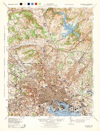
1944 Map of Baltimore
USGS Topo · Published 1944About this map
The dense industrial and residential grid of Baltimore anchors this mid-century survey, revealing the city's complex interface with the Patapsco River and its surrounding hill country. At the harbor's edge, critical landmarks like Fort McHenry National Mon, Ferry Bar, and the massive rail infrastructure of the Baltimore & Ohio RR define the waterfront. To the north, the sprawling Loch Raven Reservoir dominates the drainage of Gunpowder Falls, surrounded by established suburban nodes such as Towson, Lutherville, and Cockeysville.
Find a feature on this map
190 named features on this map. Tap any name to fly to it.
Don’t see what you’re looking for? This feature index may not catch every label — zoom into the map to look around manually.
Map Details
Editions of this 1944 Baltimore Map
This is the sole edition of this map. No revisions or reprints were ever made.
Other maps of this area

1892 · Laurel
USGS Topo · 1:62,500

1892 · Ellicott
USGS Topo · 1:62,500

1893 · North Point
USGS Topo · 1:62,500

1893 · Gunpowder
USGS Topo · 1:62,500

1894 · Ellicott
USGS Topo · 1:62,500

1894 · Laurel
USGS Topo · 1:62,500

1894 · Baltimore
USGS Topo · 1:62,500

1894 · Relay
USGS Topo · 1:62,500

1897 · Laurel
USGS Topo · 1:62,500

1898 · Tolchester
USGS Topo · 1:125,000