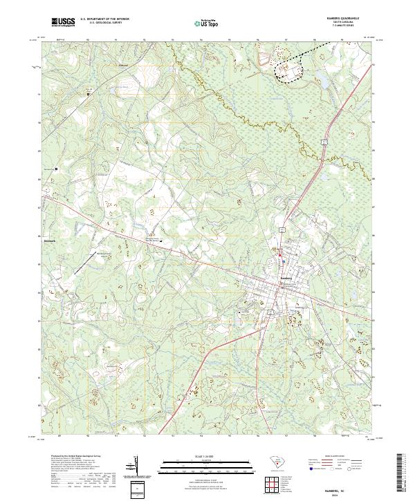
2024 Map of Bamberg
USGS Topo · Published 2024About this map
The town of Bamberg serves as the central hub of this South Carolina landscape, anchored by the Bamberg County Courthouse and a grid of streets that transition into a rural network of named roads like Fire Tower Rd and Watermelon Rd. The terrain is defined by the wetlands and slow-moving waters of the South Fork Edisto River and its many tributaries, including Lemon Creek and Roberts Swamp. These waterways are flanked by numerous low-lying features such as Cowford Lake and Gahnts Bay, reflecting the hydrologic character of the Coastal Plain.
Find a feature on this map
136 named features on this map. Tap any name to fly to it.
Don’t see what you’re looking for? This feature index may not catch every label — zoom into the map to look around manually.
Map Details
Editions of this 2024 Bamberg Map
This is the sole edition of this map. No revisions or reprints were ever made.
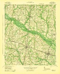
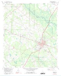
Historical Maps of Denmark Through Time
5 maps found