
Loading...
Loading map...1920 Map of Bamberg
USGS Topo · Published 1920About this map
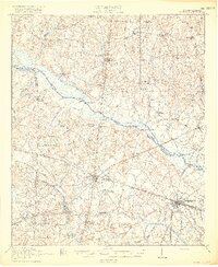
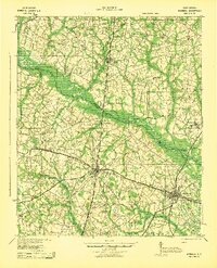
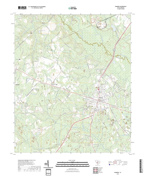
Denmark and Bamberg emerge as critical rail hubs in this post-World War I survey, where the Southern and Seaboard Air Line railroads intersect the Coast Line and the Bamberg Ehrhardt And Walterboro lines. The landscape is defined by the winding South Fork Edisto River, dotted with river crossings such as Holman Bridge and historically named landings like Kittrell Landing and Hutto Landing.
Find a feature on this map
91 named features on this map. Tap any name to fly to it.
Don’t see what you’re looking for? This feature index may not catch every label — zoom into the map to look around manually.
Map Details
Date Portrayed1920
Date Published1920
PublisherU.S. Geological Survey
Map TypeTopographic
Scale1:62,500
Physical Dimensions16.4 x 19.6 inches
Editions of this 1920 Bamberg Map
2 editions found
Historical Maps of Bamberg Through Time
9 maps found

Featured Locations
Source Details
SourceU.S. Geological Survey
CopyrightPublic Domain