
1921 Map of Lodge
USGS Topo · Published 1921About this map
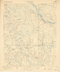
The Salkehatchie River and Edisto River drainage basins define the rural landscape of this South Carolina Lowcountry region during the early 1920s. A dense network of swampy terrain, including Schofield Swamp and Little Swamp, surrounds the elevated ridges where settlements and agriculture are concentrated. The era's transportation network is prominently displayed, from the historic Charleston and Augusta Road to the industrial presence of the Hampton and Branchville RR and numerous Lumber RR spurs. Local community life is rooted in its numerous schoolhouses and churches, such as Hunters Chapel, Zion Church, and McIlhenny School, many of which served dispersed homesteads. The map illustrates a transitional period of development between the county lines of Bamberg and Colleton, where small rail-side hamlets like Lodge and Williams functioned as vital hubs for the regional timber and agricultural economies.
Find a feature on this map
61 named features on this map. Tap any name to fly to it.
Don’t see what you’re looking for? This feature index may not catch every label — zoom into the map to look around manually.
Map Details
Editions of this 1921 Lodge Map
3 editions found
Other maps of this area

1918 · Walterboro
USGS Topo · 1:62,500

1918 · Varnville
USGS Topo · 1:62,500

1919 · Olar
USGS Topo · 1:62,500

1919 · Bamberg
USGS Topo · 1:48,000

1919 · Cummings
USGS Topo · 1:62,500

1919 · Lodge
USGS Topo · 1:62,500

1920 · Bowman
USGS Topo · 1:48,000

1920 · Lodge
USGS Topo · 1:48,000

1920 · Bamberg
USGS Topo · 1:62,500

1920 · Orangeburg
USGS Topo · 1:48,000