1920 Map of Orangeburg
USGS Topo · Published 1920About this map
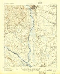
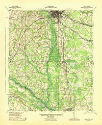
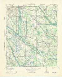
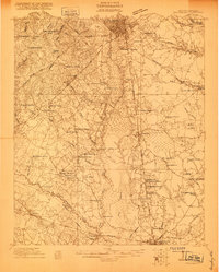
Orangeburg serves as the focal point for this early twentieth-century survey, which details a landscape defined by the winding North Fork Edisto River and an extensive network of rural schools and churches. The agrarian character of the county is evident in the presence of the County Farm and several educational institutions like Bryants Academy and Poplar Spring School. The Atlantic Coast Line and Southern Railroad provide the primary transit corridors, connecting the hub of Orangeburg to outlying communities such as Rowesville and Branchville.
Find a feature on this map
67 named features on this map. Tap any name to fly to it.
Don’t see what you’re looking for? This feature index may not catch every label — zoom into the map to look around manually.
Map Details
Editions of this 1920 Orangeburg Map
This is the sole edition of this map. No revisions or reprints were ever made.
Historical Maps of Orangeburg Through Time
4 maps found