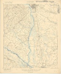
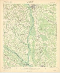
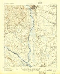
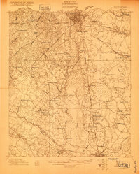
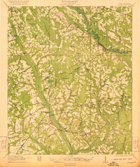
1921 Map of Orangeburg
USGS Topo · Published 1919About this map
The city of Orangeburg serves as the focal point for this post-war survey, where the confluence of the North Fork Edisto River and several major swamps dictates the movement of people and industry. The presence of the U S Fish Hatchery and the County Farm northeast of the city center highlights early 20th-century public infrastructure. This region is remarkably dense with rural institutions, including Bryants Academy, Calvary School, and St Lukes Church, which suggest a well-established social fabric in the surrounding agricultural lands. Navigation across the wetlands was facilitated by historically named crossings such as Cannon Bridge and the Rowesville Bridge. The southern portion of the sheet shows the heavy influence of the Southern and Atlantic Coast Line railroads on settlements like Branchville and Rowesville, marking them as vital nodes in the coastal plains rail network.
Find a feature on this map
71 named features on this map. Tap any name to fly to it.
Don’t see what you’re looking for? This feature index may not catch every label — zoom into the map to look around manually.
Map Details
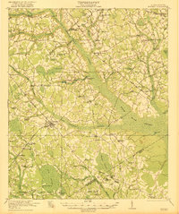
Editions of this 1921 Orangeburg Map
3 editions found
Other maps of this area

1919 · Olar
USGS Topo · 1:62,500

1919 · Bamberg
USGS Topo · 1:48,000

1919 · Lodge
USGS Topo · 1:62,500

1920 · Bowman
USGS Topo · 1:48,000

1920 · Lodge
USGS Topo · 1:48,000

1920 · Bamberg
USGS Topo · 1:62,500
1920 · Orangeburg
USGS Topo · 1:48,000

1920 · St. George
USGS Topo · 1:48,000
1921 · Lodge
USGS Topo · 1:62,500
1921 · Bowman
USGS Topo · 1:62,500