
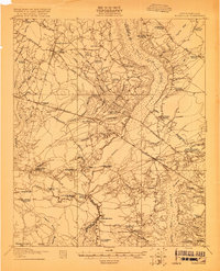
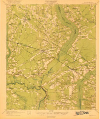
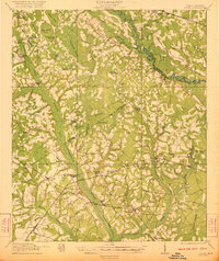
1920 Map of Bowman
USGS Topo · Published 1920About this map
Bowman serves as the central hub of this South Carolina landscape, where a dense network of country schools and rural churches defines the community structure. The map captures an era when education and faith were deeply localized, as evidenced by the sheer number of combined sites like Shiloh Church Mt Zion School and Andrew Chapel School. To the north and east, the vast wetlands of Four Hole Swamp and Wodpoo Swamp dominate the topography, dictating the path of the Atlantic Coast Line railroad and the Orangeburg Road.
Find a feature on this map
90 named features on this map. Tap any name to fly to it.
Don’t see what you’re looking for? This feature index may not catch every label — zoom into the map to look around manually.
Map Details
Editions of this 1920 Bowman Map
This is the sole edition of this map. No revisions or reprints were ever made.
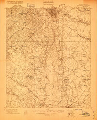
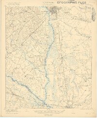
Other maps of this area
1919 · Ridgeville
USGS Topo · 1:48,000

1919 · Lodge
USGS Topo · 1:62,500

1920 · Eutawville
USGS Topo · 1:48,000

1920 · Lodge
USGS Topo · 1:48,000
1920 · Ridgeville
USGS Topo · 1:62,500
1920 · Orangeburg
USGS Topo · 1:48,000

1920 · St. George
USGS Topo · 1:48,000
1921 · Orangeburg
USGS Topo · 1:62,500
1921 · Lodge
USGS Topo · 1:62,500
1921 · Bowman
USGS Topo · 1:62,500