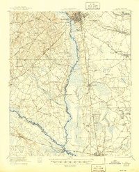
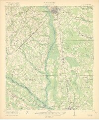
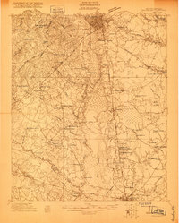
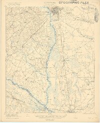
1921 Map of Orangeburg
USGS Topo · Published 1945About this map
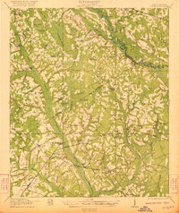
The city of Orangeburg serves as the focal point for this interior South Carolina landscape, where the Edisto River and South Fork Edisto River converge near the Embree settlement. The map reveals a robust network of early 20th-century rural infrastructure, characterized by numerous country schools such as Snake Swamp School, Oldfield School, and Pine Forest School, alongside significant local institutions like the U S Fish Hatchery and County Farm.
Find a feature on this map
69 named features on this map. Tap any name to fly to it.
Don’t see what you’re looking for? This feature index may not catch every label — zoom into the map to look around manually.
Map Details
Editions of this 1921 Orangeburg Map
3 editions found
Other maps of this area

1919 · Olar
USGS Topo · 1:62,500

1919 · Bamberg
USGS Topo · 1:48,000

1919 · Lodge
USGS Topo · 1:62,500

1920 · Bowman
USGS Topo · 1:48,000

1920 · Lodge
USGS Topo · 1:48,000

1920 · Bamberg
USGS Topo · 1:62,500
1920 · Orangeburg
USGS Topo · 1:48,000

1920 · St. George
USGS Topo · 1:48,000
1921 · Orangeburg
USGS Topo · 1:62,500
1921 · Lodge
USGS Topo · 1:62,500