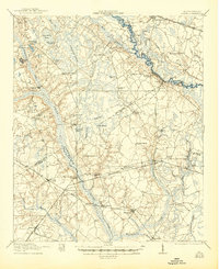
1921 Map of Lodge
USGS Topo · Published 1944About this map
Lodge and Branchville anchor this lowcountry landscape during a period of active timber harvesting and rail expansion. The survey shows a region defined by its complex hydrology, where the Edisto River and Little Salkehatchie River wind through numerous named bays and swamps. The presence of the Lumber RR and Atlantic Coast Line indicates the industrial importance of the forests, while the dense distribution of rural institutions like Little Swamp School, Zion Church, and Sandy Run Church reveals a well-established network of small agricultural communities. The terrain is notably flat, characterized by depressions such as Tony Hill Bay and Bull Bay, which influenced the placement of early road networks like the Charleston and Augusta Road. This documentation captures the precise location of family-centered landmarks and neighborhood hubs before mid-century modernization altered the local geography.
Find a feature on this map
65 named features on this map. Tap any name to fly to it.
Don’t see what you’re looking for? This feature index may not catch every label — zoom into the map to look around manually.
Map Details
Editions of this 1921 Lodge Map
3 editions found

Other maps of this area

1918 · Walterboro
USGS Topo · 1:62,500

1918 · Varnville
USGS Topo · 1:62,500

1919 · Olar
USGS Topo · 1:62,500

1919 · Bamberg
USGS Topo · 1:48,000

1919 · Cummings
USGS Topo · 1:62,500

1919 · Lodge
USGS Topo · 1:62,500

1920 · Bowman
USGS Topo · 1:48,000

1920 · Lodge
USGS Topo · 1:48,000

1920 · Bamberg
USGS Topo · 1:62,500

1920 · Orangeburg
USGS Topo · 1:48,000