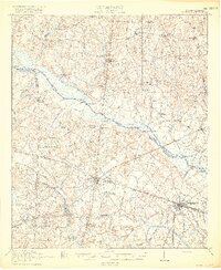
1920 Map of Bamberg
USGS Topo · Published 1920About this map
Vorhees Institute stands as a prominent landmark near Denmark in this post-war survey of the South Carolina Lowcountry. The landscape is defined by the winding course of the South Fork Edisto River, which separates Orangeburg and Bamberg counties. This riverine boundary is marked by numerous historic crossings and access points, including Holman Bridge and Hutto Landing, reflecting a time when the river was central to local movement and commerce.
Find a feature on this map
87 named features on this map. Tap any name to fly to it.
Don’t see what you’re looking for? This feature index may not catch every label — zoom into the map to look around manually.
Map Details
Editions of this 1920 Bamberg Map
2 editions found
Other maps of this area

1919 · Olar
USGS Topo · 1:62,500

1919 · Bamberg
USGS Topo · 1:48,000

1919 · Allendale
USGS Topo · 1:62,500

1919 · Lodge
USGS Topo · 1:62,500

1920 · Lodge
USGS Topo · 1:48,000

1920 · Bamberg
USGS Topo · 1:62,500

1920 · Orangeburg
USGS Topo · 1:48,000

1921 · Orangeburg
USGS Topo · 1:62,500

1921 · Lodge
USGS Topo · 1:62,500

1923 · Williston
USGS Topo · 1:48,000