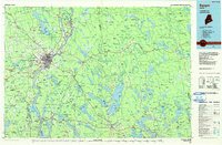
1985 Map of Bangor
USGS Topo · Published 1985About this map
The Penobscot River serves as the industrial and transportation corridor for mid-Maine, connecting the urban centers of Bangor and Brewer to the coastal ports of Bucksport and Searsport. This 1985 survey illustrates the region's complex water network, dominated by large inland bodies like Graham Lake, Green Lake, and Pushaw Lake. The presence of the Maine Central Railroad and Bangor & Aroostook Railroad alongside the river highlights the historical reliance on rail for moving timber and paper goods from the interior.
Find a feature on this map
175 named features on this map. Tap any name to fly to it.
Don’t see what you’re looking for? This feature index may not catch every label — zoom into the map to look around manually.
Map Details
Editions of this 1985 Bangor Map
This is the sole edition of this map. No revisions or reprints were ever made.
Other maps of this area

1900 · Orland
USGS Topo · 1:62,500

1900 · Bucksport
USGS Topo · 1:62,500

1902 · Orono
USGS Topo · 1:62,500

1902 · Bucksport
USGS Topo · 1:62,500

1902 · Bangor
USGS Topo · 1:62,500

1902 · Castine
USGS Topo · 1:62,500

1902 · Cherryfield
USGS Topo · 1:62,500

1904 · Castine
USGS Topo · 1:62,500

1904 · Cherryfield
USGS Topo · 1:62,500

1904 · Mount Desert
USGS Topo · 1:62,500