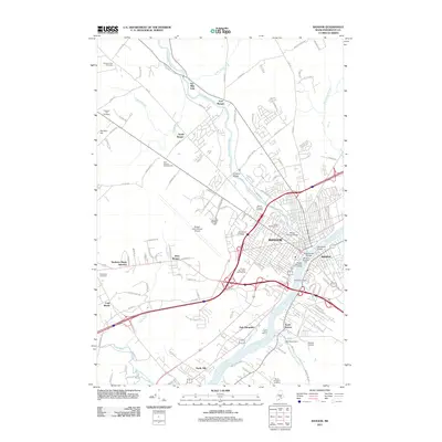
2011 Map of Bangor
USGS Topo · Published 2011About this map
The Penobscot River defines the industrial and civic heart of this region, separating the city of Bangor from Brewer. This early 21st-century landscape reveals a dense network of transportation and historical infrastructure, from the prominent Bangor International Airport to the enduring Thomas Hill Standpipe. The waterway is bridged by the Chamberlain Bridge and the Penobscot Bridge, while the Kenduskeag Stream winds through the city's north, passing the Morse Covered Bridge and Bullseye Bridge.
Find a feature on this map
134 named features on this map. Tap any name to fly to it.
Don’t see what you’re looking for? This feature index may not catch every label — zoom into the map to look around manually.
Map Details
Editions of this 2011 Bangor Map
This is the sole edition of this map. No revisions or reprints were ever made.
Other maps of this area

1900 · Orland
USGS Topo · 1:62,500

1900 · Bucksport
USGS Topo · 1:62,500

1902 · Orono
USGS Topo · 1:62,500

1902 · Bucksport
USGS Topo · 1:62,500

1902 · Bangor
USGS Topo · 1:62,500

1942 · Orland
USGS Topo · 1:62,500

1942 · Bangor
USGS Topo · 1:62,500

1942 · Bucksport
USGS Topo · 1:62,500

1944 · Orono
USGS Topo · 1:62,500

1946 · Bangor
USGS Topo · 1:62,500