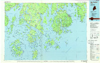
1985 Map of Bar Harbor
USGS Topo · Published 1985About this map
Mount Desert Island and its surrounding archipelago define this mid-1980s coastal survey, illustrating the complex relationship between the Maine granite coast and the Atlantic Ocean. The map documents the extensive reach of Acadia National Park across the islands and the Schoodic Peninsula, while capturing the established maritime settlements of Bar Harbor, Southwest Harbor, and Stonington.
Find a feature on this map
107 named features on this map. Tap any name to fly to it.
Don’t see what you’re looking for? This feature index may not catch every label — zoom into the map to look around manually.
Map Details
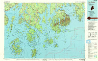
Editions of this 1985 Bar Harbor Map
2 editions found
Other maps of this area

1900 · Orland
USGS Topo · 1:62,500

1900 · Bucksport
USGS Topo · 1:62,500

1902 · Bucksport
USGS Topo · 1:62,500

1902 · Castine
USGS Topo · 1:62,500

1902 · Cherryfield
USGS Topo · 1:62,500

1904 · Deer Isle
USGS Topo · 1:62,500

1904 · Castine
USGS Topo · 1:62,500

1904 · Cherryfield
USGS Topo · 1:62,500

1904 · Mount Desert
USGS Topo · 1:62,500

1904 · Swan Island
USGS Topo · 1:62,500