2022 Map of Barboursville
USGS Topo · Published 2022About this map
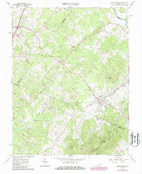
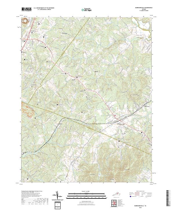
Barboursville and its surrounding Piedmont landscape are defined by the convergence of several county boundaries, where Orange, Greene, Madison, and Albemarle counties meet near the foothills of the Southwest Mountains. The terrain transitions from the alluvial bottomlands of the Rapidan River and Blue Run to prominent peaks like Hardwick Mtn and Peters Mtn. This area is dense with family history, marked by numerous private burial grounds such as the Morris Family Cem and the Shifflett Family Cem. The map illustrates a rural settlement pattern established along historic corridors like the Spotswood Trl, connecting crossroads communities such as Burnley, Eheart, and Albano. The distribution of churches, including Bethany Baptist Church Cem and Knights Chapel Cem, reflects the long-standing social anchors of these Virginia hamlets, while the Francis Beck Gravesite provides a specific point of interest for local genealogists.
Find a feature on this map
139 named features on this map. Tap any name to fly to it.
Don’t see what you’re looking for? This feature index may not catch every label — zoom into the map to look around manually.
Map Details
Editions of this 2022 Barboursville Map
This is the sole edition of this map. No revisions or reprints were ever made.
Historical Maps of Newtown Through Time
3 maps found