1977 Map of Barboursville
USGS Topo · Published 1982About this map
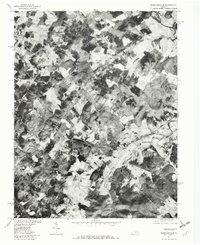
The Rapidan River flows along the northeastern boundary of this rural Virginia landscape, captured in a 1977 orthophotograph. This orthophotoquad format offers a rare photographic view of the Piedmont terrain, revealing the precise density of woodlots and the geometry of active agricultural fields surrounding Barboursville and Ruckersville. The imagery documents the distribution of crossroads settlements and small hamlets like Eheart, Burnley, and Tibbstown before late-century development altered the rural character. By combining aerial photography with topographic labels, the map provides an essential baseline for land use near Blue Run and Marsh Run, showing the exact placement of individual farmsteads and rural dwellings during the mid-1970s.
Find a feature on this map
10 named features on this map. Tap any name to fly to it.
Don’t see what you’re looking for? This feature index may not catch every label — zoom into the map to look around manually.
Map Details
Editions of this 1977 Barboursville Map
This is the sole edition of this map. No revisions or reprints were ever made.
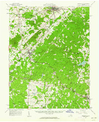
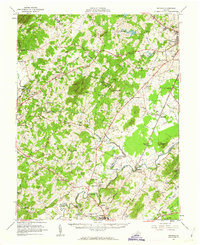
Other maps of this area

1892 · Gordonsville
USGS Topo · 1:125,000

1930 · Madison
USGS Topo · 1:48,000

1933 · Madison
USGS Topo · 1:62,500

1935 · Charlottesville
USGS Topo · 1:62,500

1939 · Charlottesville
USGS Topo · 1:62,500

1949 · Charlottesville
USGS Topo · 1:250,000

1949 · Charlottesville
USGS Topo · 1:62,500

1956 · Charlottesville
USGS Topo · 1:250,000
1961 · Gordonsville
USGS Topo · 1:62,500
1961 · Rapidan
USGS Topo · 1:62,500