2024 Map of Bardolph
USGS Topo · Published 2024About this map
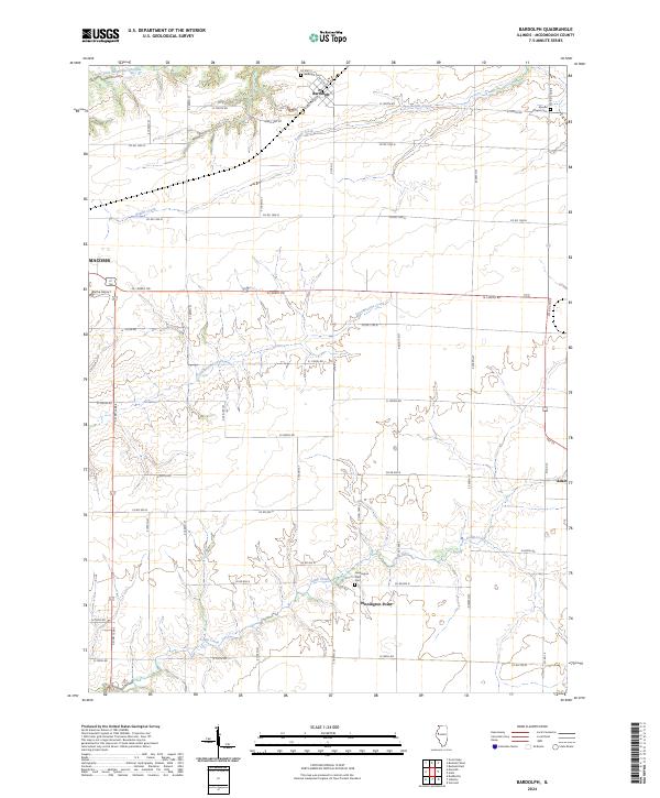
The village of Bardolph anchors the northern portion of this McDonough County landscape, characterized by a grid of agricultural roads and winding watercourses. Three major streams—Kepple Creek, Troublesome Creek, and Camp Creek—intersect the prairie, creating more varied elevation around Pennington Point than in the surrounding level fields. This 2024 survey documents the enduring layout of rural settlements like Adair and the eastern outskirts of Macomb. Local history and genealogy are well-represented by the location of several significant burial grounds, including Bardolph Cem, Mound Chapel Cem, and Pennington Point Cem. The presence of Blythe Airport near the western edge and the network of county routes like Co Hwy 2 and N 1200th Rd illustrate the modern transportation infrastructure that maintains the connectivity of these agricultural communities.
Find a feature on this map
49 named features on this map. Tap any name to fly to it.
Don’t see what you’re looking for? This feature index may not catch every label — zoom into the map to look around manually.
Map Details
Editions of this 2024 Bardolph Map
This is the sole edition of this map. No revisions or reprints were ever made.
