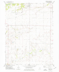
1974 Map of Bardolph
USGS Topo · Published 1977About this map
The village of Bardolph sits at the intersection of prairie topography and the Burlington Northern railroad, serving as a focal point for this section of McDonough County. The landscape is defined by the branching drainage patterns of Kepple Creek, Troublesome Creek, and the Fork La Moine River in the northwest, which carve intricate valleys into the surrounding farmland. These watercourses historically dictated the placement of early infrastructure, from the small settlement at Pennington Point to rural landmarks like Camp Creek Ch and the neighboring Townhall. Local aviation is represented by both the Macomb Clugston Airport and the Palmer Landing Strip, illustrating the evolution of transport in this agricultural region. For genealogists, the map preserves the exact locations of the Mound Cem and School No 84, providing a clear spatial context for 20th-century rural life and community organization.
Find a feature on this map
17 named features on this map. Tap any name to fly to it.
Don’t see what you’re looking for? This feature index may not catch every label — zoom into the map to look around manually.
Map Details
Editions of this 1974 Bardolph Map
This is the sole edition of this map. No revisions or reprints were ever made.
Other maps of this area

1912 · Macomb
USGS Topo · 1:62,500

1914 · Macomb
USGS Topo · 1:62,500

1915 · Avon
USGS Topo · 1:62,500

1916 · Good Hope
USGS Topo · 1:62,500

1918 · Vermont
USGS Topo · 1:62,500

1918 · Good Hope
USGS Topo · 1:62,500

1921 · Vermont
USGS Topo · 1:62,500

1944 · Avon
USGS Topo · 1:62,500

1947 · Vermont
USGS Topo · 1:24,000

1947 · Adair
USGS Topo · 1:24,000