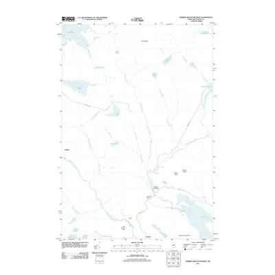
2011 Map of Barren Mountain West
USGS Topo · Published 2011About this map
Big Wilson Stream carves through the Piscataquis County landscape, anchoring a region defined by its timber heritage and mountain terrain in the early 21st century. The map highlights specific operational outposts like Saint Regis Depot Camp and Camp Twelve, reflecting the area's continued connection to the forest products industry. These small settlements and work camps are interspersed among dramatic geographical landmarks, including the precipitous Big Wilson Cliffs and the jagged Barren Ledges.
Find a feature on this map
46 named features on this map. Tap any name to fly to it.
Don’t see what you’re looking for? This feature index may not catch every label — zoom into the map to look around manually.
Map Details
Editions of this 2011 Barren Mountain West Map
This is the sole edition of this map. No revisions or reprints were ever made.
Other maps of this area

1920 · Moosehead Lake
USGS Topo · 1:62,500

1922 · Moosehead Lake
USGS Topo · 1:62,500

1930 · Moosehead Lake
USGS Topo · 1:62,500

1944 · Moosehead Lake
USGS Topo · 1:62,500

1950 · Sebec Lake
USGS Topo · 1:62,500

1951 · Greenville
USGS Topo · 1:62,500

1952 · First Roach Pond
USGS Topo · 1:62,500

1954 · Millinocket
USGS Topo · 1:250,000

1957 · Moosehead Lake
USGS Topo · 1:62,500

1958 · Millinocket
USGS Topo · 1:250,000
Featured Places
- Greenville, ME
- Elliottsville Township, ME
- Bowdoin College Grant West Township, ME
- Piscataquis County, ME
- United States