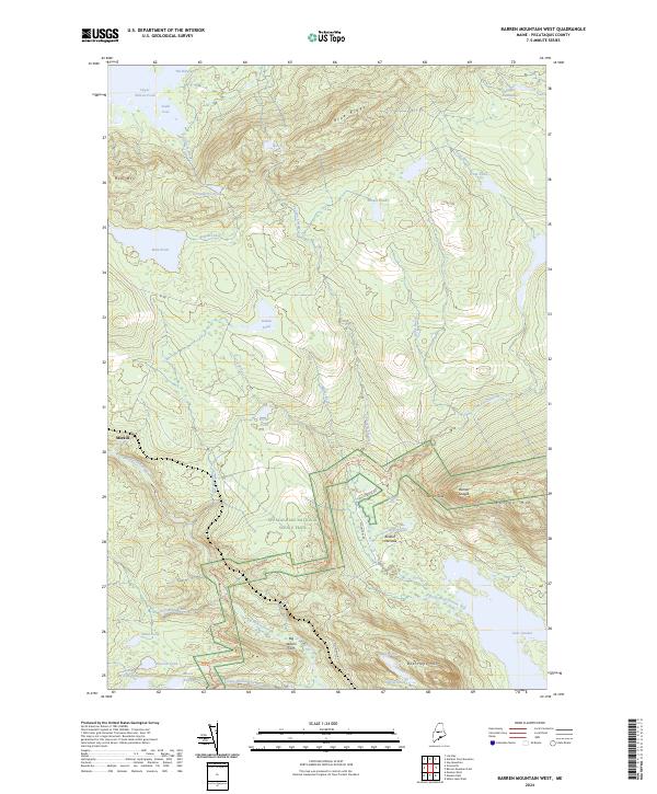
2024 Map of Barren Mountain West
USGS Topo · Published 2024About this map
Appalachian National Scenic Trail winds through this Piscataquis County landscape, crossing a complex network of streams and ridges that define the Maine wilderness. The map reveals a geography dominated by water and high relief, from the expansive Upper Wilson Pond and its constricted passage at The Narrows to the steep eastern faces of Boarstone Mtn and the Barren Ledges. The small settlement at Morkill stands as a rare point of named habitation in an area otherwise characterized by timber roads like Ki Rd and prominent natural landmarks such as Slugundy Falls. The arrangement of features like Bodfish Intervale suggests the importance of lower-lying meadows amidst the surrounding peaks, while named water bodies like Rum Pond and Secret Pond indicate a well-traversed backcountry often utilized for recreation and resource management.
Find a feature on this map
46 named features on this map. Tap any name to fly to it.
Don’t see what you’re looking for? This feature index may not catch every label — zoom into the map to look around manually.
Map Details
Editions of this 2024 Barren Mountain West Map
This is the sole edition of this map. No revisions or reprints were ever made.
Other maps of this area

1920 · Moosehead Lake
USGS Topo · 1:62,500

1922 · Moosehead Lake
USGS Topo · 1:62,500

1930 · Moosehead Lake
USGS Topo · 1:62,500

1944 · Moosehead Lake
USGS Topo · 1:62,500

1950 · Sebec Lake
USGS Topo · 1:62,500

1951 · Greenville
USGS Topo · 1:62,500

1952 · First Roach Pond
USGS Topo · 1:62,500

1954 · Millinocket
USGS Topo · 1:250,000

1957 · Moosehead Lake
USGS Topo · 1:62,500

1958 · Millinocket
USGS Topo · 1:250,000
Featured Places
- Greenville, ME
- Elliottsville Township, ME
- Bowdoin College Grant West Township, ME
- Piscataquis County, ME
- United States