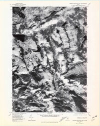
1977 Map of Barren Mountain West
USGS Topo · Published 1981About this map
Lake Onawa anchors the southeastern corner of this 1977 orthophotoquad, showing the deep, forested interior of Piscataquis County as captured by aerial photography on November 1st of that year. The imagery reveals the stark contrast of water and timbered ridges, with the steep slopes of Barren Mountain and Boarstone Mountain rising over the surrounding drainage basins. This particular study captures the landscape in a transitional state, likely following the autumn leaf drop, which provides exceptional clarity for tracing the paths of Big Wilson Stream and Long Pond Stream. Notable water bodies such as Upper Wilson Pond, Rum Pond, and Long Pond are dispersed throughout the heavily wooded terrain. Unlike a traditional line-drawn map, this photographic record shows the actual texture of the forest canopy and the precise shoreline of the Blue Ridge highlands during the late 1970s.
Find a feature on this map
9 named features on this map. Tap any name to fly to it.
Don’t see what you’re looking for? This feature index may not catch every label — zoom into the map to look around manually.
Map Details
Editions of this 1977 Barren Mountain West Map
This is the sole edition of this map. No revisions or reprints were ever made.
Other maps of this area

1920 · Moosehead Lake
USGS Topo · 1:62,500

1922 · Moosehead Lake
USGS Topo · 1:62,500

1930 · Moosehead Lake
USGS Topo · 1:62,500

1944 · Moosehead Lake
USGS Topo · 1:62,500

1950 · Sebec Lake
USGS Topo · 1:62,500

1951 · Greenville
USGS Topo · 1:62,500

1952 · First Roach Pond
USGS Topo · 1:62,500

1954 · Millinocket
USGS Topo · 1:250,000

1957 · Moosehead Lake
USGS Topo · 1:62,500

1958 · Millinocket
USGS Topo · 1:250,000
Featured Places
- Greenville, ME
- Bowdoin College Grant West Township, ME
- Elliottsville Township, ME
- Piscataquis County, ME
- United States