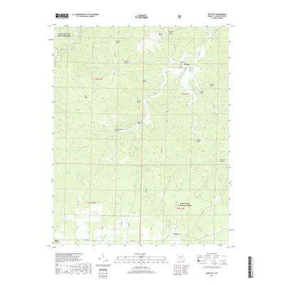
2017 Map of Bartlett
USGS Topo · Published 2017About this map
Bartlett and Delaware sit within a landscape defined by the deep incisions of the Ozark Plateau, where numerous named hollows drain toward central watercourses. The northern portion of this area is protected by the Ozark National Scenic Riverway, while the southern reaches fall within the Mark Twain National Forest. Local heritage is anchored by sites such as the Delaware Cem and Rader Cem, which overlook the complex topography of Pine Hollow and Larkin Hollow. The drainage pattern is complex, with Mahans Cr and Hurricane Cr cutting through the terrain, supported by distinctive natural features like Buckhart Spring. Further south, the community of Birch Tree borders the forest lands, connected by a network of rural routes like State Hwy E that navigate the ridges between Jam Up Hollow and Rail Tree Hollow.
Find a feature on this map
47 named features on this map. Tap any name to fly to it.
Don’t see what you’re looking for? This feature index may not catch every label — zoom into the map to look around manually.
Map Details
Editions of this 2017 Bartlett Map
This is the sole edition of this map. No revisions or reprints were ever made.
Other maps of this area

1915 · Eminence
USGS Topo · 1:62,500

1917 · Eminence
USGS Topo · 1:62,500

1931 · Bandyville
USGS Topo · 1:48,000

1944 · Birch Tree
USGS Topo · 1:62,500

1945 · Montier
USGS Topo · 1:62,500

1946 · Summersville
USGS Topo · 1:62,500

1948 · Montier
USGS Topo · 1:62,500

1948 · Birch Tree
USGS Topo · 1:62,500

1948 · Summersville
USGS Topo · 1:62,500

1949 · Rolla
USGS Topo · 1:250,000