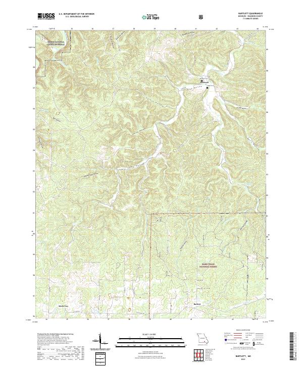
2021 Map of Bartlett
USGS Topo · Published 2021About this map
The rugged Ozark landscape of Shannon County is deeply incised by a dense network of hollows, reflecting a topography defined by the Ozark National Scenic Riverway and the Mark Twain National Forest. The settlement of Bartlett sits at the southern edge, while the northern terrain is carved by names like Jam Up Hollow, Stillhouse Hollow, and Rail Tree Hollow. These descriptors hint at the historic land use and local geography of a region shaped by its springs and creek branches.
Find a feature on this map
39 named features on this map. Tap any name to fly to it.
Don’t see what you’re looking for? This feature index may not catch every label — zoom into the map to look around manually.
Map Details
Editions of this 2021 Bartlett Map
This is the sole edition of this map. No revisions or reprints were ever made.
Other maps of this area

1915 · Eminence
USGS Topo · 1:62,500

1917 · Eminence
USGS Topo · 1:62,500

1931 · Bandyville
USGS Topo · 1:48,000

1944 · Birch Tree
USGS Topo · 1:62,500

1945 · Montier
USGS Topo · 1:62,500

1946 · Summersville
USGS Topo · 1:62,500

1948 · Montier
USGS Topo · 1:62,500

1948 · Birch Tree
USGS Topo · 1:62,500

1948 · Summersville
USGS Topo · 1:62,500

1949 · Rolla
USGS Topo · 1:250,000