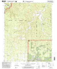
1997 Map of Bartlett
USGS Topo · Published 1999About this map
Bartlett Road winds through the southern reaches of this landscape, connecting the small settlement of Bartlett to the surrounding timberlands and hollows. The terrain is defined by a dense network of drainage systems, including Larkin Hollow and Jam Up Hollow, which feed into larger water bodies like Rocky Creek. The presence of the Manger of Bethlehem Church and local burial sites such as Delaware Cemetery and Rader Cemetery provide specific points of interest for those researching the community's social fabric and genealogy.
Find a feature on this map
26 named features on this map. Tap any name to fly to it.
Don’t see what you’re looking for? This feature index may not catch every label — zoom into the map to look around manually.
Map Details
Editions of this 1997 Bartlett Map
This is the sole edition of this map. No revisions or reprints were ever made.
Other maps of this area

1915 · Eminence
USGS Topo · 1:62,500

1917 · Eminence
USGS Topo · 1:62,500

1931 · Bandyville
USGS Topo · 1:48,000

1944 · Birch Tree
USGS Topo · 1:62,500

1945 · Montier
USGS Topo · 1:62,500

1946 · Summersville
USGS Topo · 1:62,500

1948 · Montier
USGS Topo · 1:62,500

1948 · Birch Tree
USGS Topo · 1:62,500

1948 · Summersville
USGS Topo · 1:62,500

1949 · Rolla
USGS Topo · 1:250,000