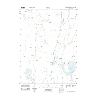
2012 Map of Bash Bish Falls
USGS Topo · Published 2012About this map
Bash Bish Falls and the surrounding tri-state highlands mark a landscape defined by high peaks and scattered water bodies where Massachusetts, Connecticut, and New York meet. The terrain is dominated by significant elevations such as Mount Everett, Bear Mountain, and Mount Frissell, providing a backdrop for small settlements like Guilder Hollow and Taconic. This 2012 survey illustrates a region where local infrastructure and natural landmarks are closely intertwined, featuring the Mount Washington Lookout Tower and the Churchill Cem near the banks of Dry Brook. The southern portion of the quadrangle opens into the expansive waters of Washining Lake and Washinee Lake, which together form the Twin Lakes area. Winding roads such as Plantain Pond Rd and Mountain Rd connect these remote valleys and ridges, tracing the historic routes through the Taconic Mountains.
Find a feature on this map
102 named features on this map. Tap any name to fly to it.
Don’t see what you’re looking for? This feature index may not catch every label — zoom into the map to look around manually.
Map Details
Editions of this 2012 Bash Bish Falls Map
This is the sole edition of this map. No revisions or reprints were ever made.
Other maps of this area

1885 · Sheffield
USGS Topo · 1:62,500

1888 · Sheffield
USGS Topo · 1:62,500

1891 · Sheffield
USGS Topo · 1:62,500

1892 · Cornwall
USGS Topo · 1:62,500

1893 · Sheffield
USGS Topo · 1:62,500

1893 · Cornwall
USGS Topo · 1:62,500

1897 · Sheffield
USGS Topo · 1:62,500

1899 · Housatonic
USGS Topo · 1:125,000

1899 · Millbrook
USGS Topo · 1:62,500

1900 · Housatonic
USGS Topo · 1:125,000