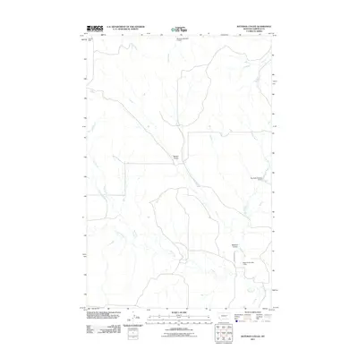
2011 Map of Bateman Coulee
USGS Topo · Published 2011About this map
Bateman Coulee and Maban Coulee define this arid landscape in Garfield County, where water management is central to the land's utility. The drainage system of Wolf Creek, Frazier Creek, and Second Creek is heavily modified by a series of stock dams and reservoirs, reflecting the ranching heritage of the Montana plains. Named infrastructure like Jensen Dam and the Big Bucks Number 11 Dam indicate the critical importance of capturing seasonal runoff in this environment. Remote access is primarily facilitated by Van Norman Rd, which winds through the southern portion of the quadrangle near Bateman Number 1 Dam. This 2011 survey captures the distribution of these essential water features across a terrain otherwise marked by high plains drainage patterns.
Find a feature on this map
12 named features on this map. Tap any name to fly to it.
Don’t see what you’re looking for? This feature index may not catch every label — zoom into the map to look around manually.
Map Details
Editions of this 2011 Bateman Coulee Map
This is the sole edition of this map. No revisions or reprints were ever made.
Other maps of this area

1954 · Jordan
USGS Topo · 1:250,000

1956 · Jordan
USGS Topo · 1:250,000

1958 · Jordan
USGS Topo · 1:250,000

1958 · Maloney Hill
USGS Topo · 1:62,500

1964 · Jordan
USGS Topo · 1:250,000

1964 · Jordan SE
USGS Topo · 1:24,000

1964 · Jordan NE
USGS Topo · 1:24,000

1964 · Ada Creek
USGS Topo · 1:24,000

1964 · Bateman Coulee
USGS Topo · 1:24,000

1964 · Black John Coulee
USGS Topo · 1:24,000