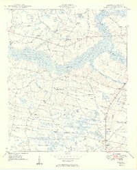
1949 Map of Bayboro
USGS Topo · Published 1949About this map
Lake Swamp dominates the center of this 1949 topographic landscape, illustrating the intricate hydrology of the Carolina bays and wetlands in Horry County. The settlement pattern is defined by a dense network of local institutions that supported a rural agrarian community, including Athens Sch, Zoan Sch, and Lewis School No 1. The drainage of the land is meticulously mapped through numerous named watercourses like Honey Comp Branch and Little Mill Branch, which feed into larger swamps. Near the settlement of Bayboro, the concentration of New Hope Ch, Bayboro Sch, and Bayboro Ch highlights the town as a local hub. The presence of several family-named burial sites, such as Graham Cem and Johnson Cem, provides essential data for genealogists tracing the established families of this low-lying region.
Find a feature on this map
58 named features on this map. Tap any name to fly to it.
Don’t see what you’re looking for? This feature index may not catch every label — zoom into the map to look around manually.
Map Details
Editions of this 1949 Bayboro Map
2 editions found
Other maps of this area

1937 · Nixonville
USGS Topo · 1:48,000

1942 · Nixonville
USGS Topo · 1:62,500

1943 · Adrian
USGS Topo · 1:24,000

1943 · Horry
USGS Topo · 1:24,000

1944 · Adrian
USGS Topo · 1:31,680

1948 · Galivants Ferry
USGS Topo · 1:24,000

1948 · Nichols
USGS Topo · 1:24,000

1948 · Bayboro
USGS Topo · 1:24,000

1949 · Bayboro
USGS Topo · 1:24,000

1949 · Duford
USGS Topo · 1:24,000