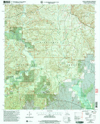
2003 Map of Bayou L'ivrogne
USGS Topo · Published 2005About this map
Kisatchie National Forest dominates this section of Natchitoches Parish, where the complex drainage of Kisatchie Bayou and Bayou L'ivrogne carves through the distinct topography of the Red Dirt region and the Kisatchie Hills. The settlement of Mink serves as a lone hub in the southern portion, while the Red Dirt National Wildlife Management Preserve occupies the central interior. This landscape is defined by its recreation and conservation history, featuring the Longleaf Trail and the Caroline Dormon Byway, named for the pioneering Louisiana conservationist. Local heritage is preserved at sites like Key Cem and the Red Dirt Lookout, while water management is noted at Beasley Dam and Beasley Spr. The map illustrates the persistence of small rural communities and managed timberlands in the early 21st century.
Find a feature on this map
26 named features on this map. Tap any name to fly to it.
Don’t see what you’re looking for? This feature index may not catch every label — zoom into the map to look around manually.
Map Details
Editions of this 2003 Bayou L'ivrogne Map
This is the sole edition of this map. No revisions or reprints were ever made.
Other maps of this area

1937 · Chopin SW
USGS Topo · 1:31,680

1937 · Chopin NW
USGS Topo · 1:31,680

1937 · Bellwood
USGS Topo · 1:31,680

1937 · Montgomery
USGS Topo · 1:62,500

1937 · Cloutierville
USGS Topo · 1:31,680

1937 · Cypress
USGS Topo · 1:31,680

1942 · Kisatchie
USGS Topo · 1:62,500

1942 · Montgomery
USGS Topo · 1:62,500

1943 · Kisatchie
USGS Topo · 1:62,500

1943 · Provencal
USGS Topo · 1:62,500