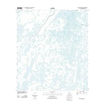
2012 Map of Bayou Sauveur
USGS Topo · Published 2012About this map
Bayou Grand Caillou dominates the southern landscape of this Terrebonne Parish survey, illustrating the intricate web of coastal waterways that define southern Louisiana. The region is characterized by an extensive network of marshes and drainage systems, where larger channels like Bayou du Large and Bayou Dufrene provide the primary structural framework for the terrain. To the northeast, the Bayou Rambio Oil and Gas Field and Bayou Rambio highlight the area's long-standing connection to the petroleum industry, showing how infrastructure is integrated into the wetland environment. Man-made interventions such as Fohs Canal and the presence of Brady Rd at the northern edge reflect the ongoing efforts to navigate and manage this fluid landscape. Small water bodies like Mound Bayou pepper the map, marking specific points of elevation and historical significance in an otherwise low-lying deltaic region.
Find a feature on this map
9 named features on this map. Tap any name to fly to it.
Don’t see what you’re looking for? This feature index may not catch every label — zoom into the map to look around manually.
Map Details
Editions of this 2012 Bayou Sauveur Map
This is the sole edition of this map. No revisions or reprints were ever made.
Other maps of this area

1894 · Bayou De Large
USGS Topo · 1:62,500

1894 · Dulac
USGS Topo · 1:62,500

1935 · Cocodrie
USGS Topo · 1:31,680

1935 · Theriot
USGS Topo · 1:31,680

1935 · Lake Mechant
USGS Topo · 1:31,680

1935 · Lake Quitman
USGS Topo · 1:31,680

1935 · Lake Gero
USGS Topo · 1:31,680

1935 · Lake Penchant
USGS Topo · 1:31,680

1940 · Bayou Du Large
USGS Topo · 1:62,500

1941 · Bayou Du Large
USGS Topo · 1:62,500