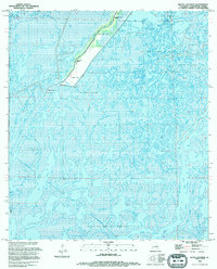
1994 Map of Bayou Sauveur
USGS Topo · Published 1994About this map
Bayou du Large and Bayou Sauveur weave through a landscape dominated by marsh and water, where the extraction of natural resources defines the human presence. In this low-lying area of Terrebonne Parish, the map reveals a network of industrial sites including the Sauveur Bayou Gas Field and the Four Isle Dome Oil and Gas Field. Communities and spiritual centers are concentrated along the narrow strips of higher ground bordering the main bayous, evidenced by the Bayou Du Large Mission, Du Large House of Prayer, and St Andrews Mission. The reliance on water and canal transportation is clear from the presence of numerous pipeline canals and labels for landmark locations like Roso and Rambio, which serve as vital markers in this intricate wetland environment.
Find a feature on this map
27 named features on this map. Tap any name to fly to it.
Don’t see what you’re looking for? This feature index may not catch every label — zoom into the map to look around manually.
Map Details
Editions of this 1994 Bayou Sauveur Map
This is the sole edition of this map. No revisions or reprints were ever made.
Other maps of this area

1894 · Bayou De Large
USGS Topo · 1:62,500

1894 · Dulac
USGS Topo · 1:62,500

1935 · Cocodrie
USGS Topo · 1:31,680

1935 · Theriot
USGS Topo · 1:31,680

1935 · Lake Mechant
USGS Topo · 1:31,680

1935 · Lake Quitman
USGS Topo · 1:31,680

1935 · Lake Gero
USGS Topo · 1:31,680

1935 · Lake Penchant
USGS Topo · 1:31,680

1940 · Bayou Du Large
USGS Topo · 1:62,500

1941 · Bayou Du Large
USGS Topo · 1:62,500