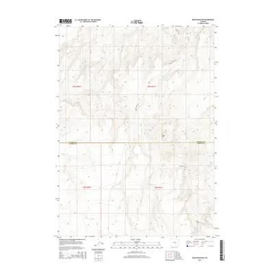
2015 Map of Bear Mountain
USGS Topo · Published 2015About this map
Bear Mtn rises above the high-country landscape where the boundary of Natrona and Carbon counties meets in the southern Wyoming interior. This topographic study documents a drainage network defined by the headwaters of Bear Cr, including its West Fork and East Fork, which carve through the terrain alongside Bolton Cr. The water management of the area is highlighted by Cook Reservoir, a significant catchment in an otherwise arid expanse. Transportation is limited to rugged corridors such as Bolton Creek Rd and Stinking Creek Rd, indicating a landscape primarily used for ranching or resource management rather than dense settlement. The map captures the specialized geography of the northern Casper region, where the deep incisions of North Fork Canyon Creek and South Fork Canyon Creek dominate the southwestern reaches.
Find a feature on this map
18 named features on this map. Tap any name to fly to it.
Don’t see what you’re looking for? This feature index may not catch every label — zoom into the map to look around manually.
Map Details
Editions of this 2015 Bear Mountain Map
This is the sole edition of this map. No revisions or reprints were ever made.
Other maps of this area

1950 · Alcova SE
USGS Topo · 1:24,000

1950 · Alcova
USGS Topo · 1:24,000

1951 · Bear Mountain
USGS Topo · 1:24,000

1951 · Bear Spring
USGS Topo · 1:24,000

1953 · Fourmile Point
USGS Topo · 1:24,000

1953 · Fourmile Ridge
USGS Topo · 1:24,000

1955 · Casper
USGS Topo · 1:250,000

1958 · Casper
USGS Topo · 1:250,000

1960 · Twin Buttes
USGS Topo · 1:24,000

1960 · Wild Irish Reservoir
USGS Topo · 1:24,000