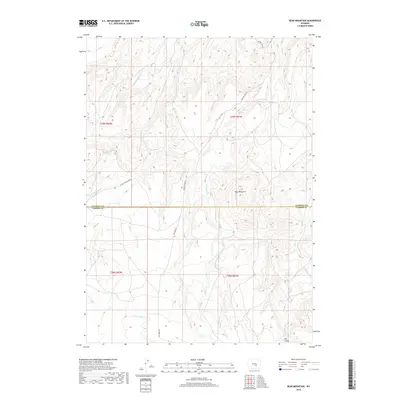
2018 Map of Bear Mountain
USGS Topo · Published 2018About this map
Bear Mountain dominates the center of this high-elevation landscape, where the boundary between Natrona and Carbon Counties bisects a network of mountain drainage systems. The terrain is defined by a dendritic pattern of creeks, including the headwaters of Bolton Cr and the branching forks of Bear Cr. A single prominent road, Bolton Creek Rd, provides the primary north-south passage through these uplands, while Dry Creek Rd follows the lower drainage to the west. The absence of established townsites reflects the remote, ranching, or public land character typical of this section of the Wyoming interior. Researchers will find a preserved look at the drainage patterns of the N Fork Canyon Creek and S Fork Canyon Cr as they appeared in the early twenty-first century.
Find a feature on this map
19 named features on this map. Tap any name to fly to it.
Don’t see what you’re looking for? This feature index may not catch every label — zoom into the map to look around manually.
Map Details
Editions of this 2018 Bear Mountain Map
This is the sole edition of this map. No revisions or reprints were ever made.
Other maps of this area

1950 · Alcova SE
USGS Topo · 1:24,000

1950 · Alcova
USGS Topo · 1:24,000

1951 · Bear Mountain
USGS Topo · 1:24,000

1951 · Bear Spring
USGS Topo · 1:24,000

1953 · Fourmile Point
USGS Topo · 1:24,000

1953 · Fourmile Ridge
USGS Topo · 1:24,000

1955 · Casper
USGS Topo · 1:250,000

1958 · Casper
USGS Topo · 1:250,000

1960 · Twin Buttes
USGS Topo · 1:24,000

1960 · Wild Irish Reservoir
USGS Topo · 1:24,000