
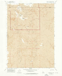
1972 Map of Bear Park West
USGS Topo · Published 1976About this map
Lava flows dominate this 1970s landscape, illustrating the raw geologic character of the high desert along the border of Blaine County and Minidoka County. The terrain is defined by vast volcanic deposits and small, isolated water features such as Gerity Reservoir in the northwest and Bear Den Lake further south. These pockets of water and the open expanse of Bear Park represent the sparse but vital landmarks in an area primarily shaped by volcanic activity. Notable elevations like Coyote Butte provide the only significant breaks in the undulating volcanic fields, serving as navigational anchors in a region where the natural environment dictates the pattern of human interest and boundary lines.
Find a feature on this map
7 named features on this map. Tap any name to fly to it.
Don’t see what you’re looking for? This feature index may not catch every label — zoom into the map to look around manually.
Map Details
Editions of this 1972 Bear Park West Map
This is the sole edition of this map. No revisions or reprints were ever made.
Other maps of this area

1955 · Idaho Falls
USGS Topo · 1:250,000

1958 · Idaho Falls
USGS Topo · 1:250,000

1972 · North Laidlaw Butte
USGS Topo · 1:24,000

1972 · Mule Butte
USGS Topo · 1:24,000

1972 · Pratt Butte
USGS Topo · 1:24,000

1972 · Bear Park SW
USGS Topo · 1:24,000

1972 · Bear Den Butte
USGS Topo · 1:24,000

1972 · Bear Park East
USGS Topo · 1:24,000

1972 · Bottleneck Lake
USGS Topo · 1:24,000
1973 · Fissure Butte
USGS Topo · 1:24,000