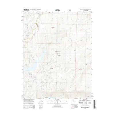
2015 Map of Bear River Reservoir
USGS Topo · Published 2015About this map
The Eldorado National Forest defines the high-country landscape in this 2015 survey, where the Bear River is harnessed by a series of significant water management features. The massive Bear River Reservoir and Lower Bear River Reservoir dominate the central terrain, while the northern edge of Salt Springs Reservoir is visible along the southern boundary. These reservoirs are fed by numerous alpine watercourses including Tragedy Cr, Cole Cr, and the Middle Fork Cosumnes River. Isolated flats and meadows like Corral Flat, Foster Meadow, and Willow Flat provide breaks in the complex topography. Transportation through this part of the Sierra Nevada is limited to seasonal routes such as S Bear River Rd and Pardoe Rd, which provide access to remote locations like Onion Valley and Upper Onion Valley.
Find a feature on this map
34 named features on this map. Tap any name to fly to it.
Don’t see what you’re looking for? This feature index may not catch every label — zoom into the map to look around manually.
Map Details
Editions of this 2015 Bear River Reservoir Map
This is the sole edition of this map. No revisions or reprints were ever made.
Other maps of this area

1889 · Pyramid Peak
USGS Topo · 1:125,000

1891 · Big Trees
USGS Topo · 1:125,000

1891 · Pyramid Peak
USGS Topo · 1:125,000

1894 · Big Trees
USGS Topo · 1:125,000

1895 · Pyramid Peak
USGS Topo · 1:125,000

1896 · Pyramid Peak
USGS Topo · 1:125,000

1897 · Big Trees
USGS Topo · 1:125,000

1901 · Big Trees
USGS Topo · 1:125,000

1947 · Sacramento
USGS Topo · 1:250,000

1948 · Sacramento
USGS Topo · 1:250,000