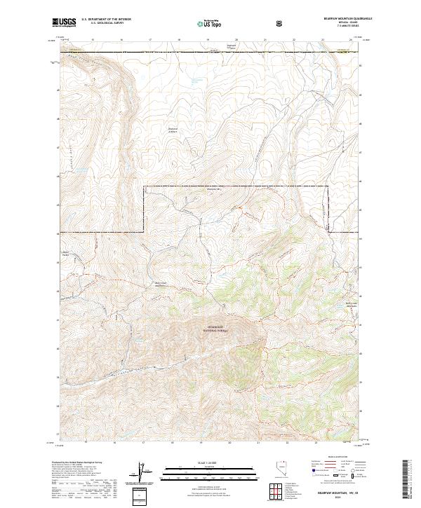
2021 Map of Bearpaw Mountain
USGS Topo · Published 2021About this map
Humboldt National Forest dominates this high-altitude borderland, where the Great Basin meets the Idaho state line. The landscape is defined by the sharp rise of the Buck Creek Mountains and the prominent peak of Bearpaw Mtn, dissected by a complex network of seasonal water sources like Zenobia Spring and Jim Bob Spring. This area represents a classic Western rangeland environment, where isolated landmarks such as Taylor Pocket and the Alvarez Ranch signify the sparse but enduring human presence in the region.
Find a feature on this map
67 named features on this map. Tap any name to fly to it.
Don’t see what you’re looking for? This feature index may not catch every label — zoom into the map to look around manually.
Map Details
Editions of this 2021 Bearpaw Mountain Map
This is the sole edition of this map. No revisions or reprints were ever made.
Other maps of this area

1936 · Rowland
USGS Topo · 1:48,000

1940 · Rowland
USGS Topo · 1:62,500

1943 · Jarbidge
USGS Topo · 1:62,500

1945 · Jarbidge
USGS Topo · 1:62,500

1955 · Twin Falls
USGS Topo · 1:250,000

1955 · Wells
USGS Topo · 1:250,000

1958 · Wells
USGS Topo · 1:250,000

1958 · Twin Falls
USGS Topo · 1:250,000

1961 · Wells
USGS Topo · 1:250,000

1979 · Cowan Reservoir
USGS Topo · 1:24,000