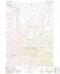
1986 Map of Bearpaw Mountain
USGS Topo · Published 1987About this map
Humboldt National Forest dominates this high-altitude landscape along the Nevada-Idaho border, where the high peaks of Bearpaw Mountain overlook a complex network of canyons and drainage systems. This 1980s survey illustrates a wilderness defined by its water sources and historical resource extraction, evidenced by scattered prospects and a Pack Trail navigating the difficult terrain. The southern reaches are carved by Rattlesnake Canyon and Young American Creek, while the remote Bruneau RS serves as a lone administrative or ranching outpost in the backcountry.
Find a feature on this map
25 named features on this map. Tap any name to fly to it.
Don’t see what you’re looking for? This feature index may not catch every label — zoom into the map to look around manually.
Map Details
Editions of this 1986 Bearpaw Mountain Map
This is the sole edition of this map. No revisions or reprints were ever made.
Other maps of this area

1936 · Rowland
USGS Topo · 1:48,000

1940 · Rowland
USGS Topo · 1:62,500

1943 · Jarbidge
USGS Topo · 1:62,500

1945 · Jarbidge
USGS Topo · 1:62,500

1955 · Twin Falls
USGS Topo · 1:250,000

1955 · Wells
USGS Topo · 1:250,000

1958 · Wells
USGS Topo · 1:250,000

1958 · Twin Falls
USGS Topo · 1:250,000

1961 · Wells
USGS Topo · 1:250,000

1979 · Cowan Reservoir
USGS Topo · 1:24,000