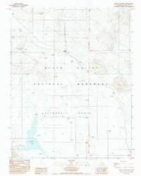
1988 Map of Beatty Junction
USGS Topo · Published 1988About this map
Death Valley National Monument reveals a landscape defined by extreme topography and hydrologic curiosities in this 1988 provisional survey. Centered on the lowlands of Cottonball Basin, the map illustrates a network of ephemeral water sources and mineral deposits, including the winding course of Salt Creek and the localized Cottonball Marsh. The intersection at Beatty Junction serves as the primary gateway for travelers on Route 190, while various Salt Flats and mineral springs like Springs (Sulphur) characterize the basin floor. Local human history is quietly noted by a lone Grave and the Picnic Area, highlighting the sparse but present footprint of visitors and residents in this arid environment. Survey markers like Usmm 33 and numerous bench marks provide exact elevations for a region famously situated below sea level.
Find a feature on this map
28 named features on this map. Tap any name to fly to it.
Don’t see what you’re looking for? This feature index may not catch every label — zoom into the map to look around manually.
Map Details
Editions of this 1988 Beatty Junction Map
This is the sole edition of this map. No revisions or reprints were ever made.
Other maps of this area

1908 · Furnace Creek
USGS Topo · 1:250,000

1908 · Ballarat
USGS Topo · 1:250,000

1910 · Furnace Creek
USGS Topo · 1:250,000

1913 · Ballarat
USGS Topo · 1:250,000

1942 · Bullfrog
USGS Topo · 1:125,000

1948 · Death Valley
USGS Topo · 1:250,000

1952 · Chloride Cliff
USGS Topo · 1:50,000

1952 · Stovepipe Wells
USGS Topo · 1:62,500

1952 · Furnace Creek
USGS Topo · 1:62,500

1952 · Emigrant Canyon
USGS Topo · 1:62,500