
1952 Map of Furnace Creek
USGS Topo · Published 1953About this map
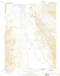
Death Valley occupies the center of this mid-century survey, revealing the extreme topography and early desert infrastructure between the Panamint Range and the Funeral Mts. The map details the core of Death Valley National Monument, centered on the developed oasis at Furnace Creek Ranch and the Furnace Creek Inn. Notable for local history is the presence of an Indian Village and the Cem located near the ranch, alongside the industrial remnants of the Harmony Borax Works (Ruins). The landscape is defined by its dramatic geological features, from the crystalline salt crust of the Devils Golf Course to the colorful formations of Artists Palette. The road network highlights the burgeoning tourism of the era, featuring the Artists Drive and the Airport at Furnace Creek Ranch, while numerous Mines tucked into the canyons point to the region's mineral prospecting history.
Find a feature on this map
42 named features on this map. Tap any name to fly to it.
Don’t see what you’re looking for? This feature index may not catch every label — zoom into the map to look around manually.
Map Details
Editions of this 1952 Furnace Creek Map
5 editions found
Other maps of this area

1908 · Furnace Creek
USGS Topo · 1:250,000

1908 · Ballarat
USGS Topo · 1:250,000

1910 · Furnace Creek
USGS Topo · 1:250,000

1913 · Ballarat
USGS Topo · 1:250,000

1942 · Bullfrog
USGS Topo · 1:125,000

1948 · Death Valley
USGS Topo · 1:250,000

1951 · Funeral Peak
USGS Topo · 1:62,500

1952 · Chloride Cliff
USGS Topo · 1:50,000

1952 · Stovepipe Wells
USGS Topo · 1:62,500

1952 · Ryan
USGS Topo · 1:62,500