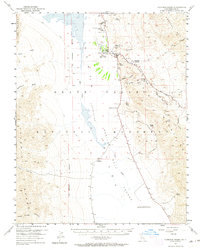
1952 Map of Furnace Creek
USGS Topo · Published 1964About this map
Death Valley reaches its lowest point on this 1952 survey, recorded at 282 feet below sea level. The map highlights the sparse but critical settlement at Furnace Creek Ranch and the nearby Indian Village, centers of activity where the Furnace Creek Inn and Airport sit near the mouth of Furnace Creek Canyon.
Find a feature on this map
41 named features on this map. Tap any name to fly to it.
Don’t see what you’re looking for? This feature index may not catch every label — zoom into the map to look around manually.
Map Details
Editions of this 1952 Furnace Creek Map
5 editions found
Other maps of this area

1908 · Furnace Creek
USGS Topo · 1:250,000

1908 · Ballarat
USGS Topo · 1:250,000

1910 · Furnace Creek
USGS Topo · 1:250,000

1913 · Ballarat
USGS Topo · 1:250,000

1942 · Bullfrog
USGS Topo · 1:125,000

1948 · Death Valley
USGS Topo · 1:250,000

1951 · Funeral Peak
USGS Topo · 1:62,500

1952 · Chloride Cliff
USGS Topo · 1:50,000

1952 · Stovepipe Wells
USGS Topo · 1:62,500

1952 · Furnace Creek
USGS Topo · 1:62,500