
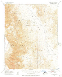
1951 Map of Funeral Peak
USGS Topo · Published 1952About this map
Dantes View provides a high-altitude vantage point over the stark terrain of Death Valley National Monument as it was mapped in the early 1950s. The landscape is defined by the heavy presence of mining history, marked by numerous unnamed Mines and Prospects scattered across the Black Mountains and Greenwater Range. The presence of the Furnace (Site) and Greenwater (Site) indicates formerly inhabited areas that had transitioned to historical markers by this era. Natural water sources were critical to life in this arid environment, evidenced by isolated spots like Greenwater Spring, Sheep Creek Spring, and Willow Spring. From the depths of Gold Valley to the heights of Funeral Peak and Smith Mountain, the map documents a network of primitive roads and trails connecting these remote points of interest.
Find a feature on this map
24 named features on this map. Tap any name to fly to it.
Don’t see what you’re looking for? This feature index may not catch every label — zoom into the map to look around manually.
Map Details
Editions of this 1951 Funeral Peak Map
4 editions found
Other maps of this area

1908 · Furnace Creek
USGS Topo · 1:250,000

1910 · Furnace Creek
USGS Topo · 1:250,000

1933 · Avawatz Mountains
USGS Topo · 1:250,000

1940 · Eagle Tank
USGS Topo · 1:62,500

1947 · Trona
USGS Topo · 1:250,000

1948 · Trona
USGS Topo · 1:250,000

1948 · Death Valley
USGS Topo · 1:250,000

1950 · Wingate Wash
USGS Topo · 1:62,500

1950 · Confidence Hills
USGS Topo · 1:62,500

1951 · Eagle Mtn
USGS Topo · 1:62,500