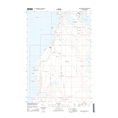
2014 Map of Beaver Island North
USGS Topo · Published 2014About this map
Saint James serves as the primary hub of activity on the northern reaches of the Beaver Archipelago, situated around the protected waters of Saint James Harbor. This 2014 survey documents the established infrastructure of the island community, including the Holy Cross Ch, Holy Cross Cem, and aviation facilities at Welke Airport and Beaver Island Airport. The landscape is defined by a series of inland water bodies like Font Lake, Barneys Lake, and Fox Lake, which are separated from the surrounding Lake Michigan by distinct coastal features such as McCauley Point and Donegal Bay. Local transportation is anchored by the Beaver Island Fry, connecting the settlement to the mainland, while a network of named tracks like Sloptown Rd and Kings Hwy provide access to the interior and residential areas at Bonner Landing.
Find a feature on this map
83 named features on this map. Tap any name to fly to it.
Don’t see what you’re looking for? This feature index may not catch every label — zoom into the map to look around manually.
Map Details
Editions of this 2014 Beaver Island North Map
This is the sole edition of this map. No revisions or reprints were ever made.
Other maps of this area

1955 · Hog Island
USGS Topo · 1:62,500

1955 · Cheboygan
USGS Topo · 1:250,000

1956 · Beaver Island
USGS Topo · 1:62,500

1958 · Cheboygan
USGS Topo · 1:250,000
1980 · Garden Island West
USGS Topo · 1:24,000

1984 · Beaver Island
USGS Topo · 1:100,000

1986 · High Island
USGS Topo · 1:24,000

1986 · Beaver Island North
USGS Topo · 1:24,000
1986 · Beaver Island South
USGS Topo · 1:24,000
1986 · Hog Island West
USGS Topo · 1:24,000