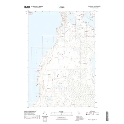
2019 Map of Beaver Island North
USGS Topo · Published 2019About this map
St James sits at the northern tip of Beaver Island, serving as the primary gateway to this Lake Michigan landscape. The settlement is centered around the protected waters of Saint James Harbor, where the ferry arrives near landmarks like the Holy Cross Cem. Inland, the terrain is defined by a dense collection of freshwater basins and wetlands, including the expansive Sweeney Swamp, Font Lake, and the more isolated Egg Lake and Greenes Lake.
Find a feature on this map
111 named features on this map. Tap any name to fly to it.
Don’t see what you’re looking for? This feature index may not catch every label — zoom into the map to look around manually.
Map Details
Editions of this 2019 Beaver Island North Map
This is the sole edition of this map. No revisions or reprints were ever made.
Other maps of this area

1955 · Hog Island
USGS Topo · 1:62,500

1955 · Cheboygan
USGS Topo · 1:250,000

1956 · Beaver Island
USGS Topo · 1:62,500

1958 · Cheboygan
USGS Topo · 1:250,000
1980 · Garden Island West
USGS Topo · 1:24,000

1984 · Beaver Island
USGS Topo · 1:100,000

1986 · High Island
USGS Topo · 1:24,000

1986 · Beaver Island North
USGS Topo · 1:24,000
1986 · Beaver Island South
USGS Topo · 1:24,000
1986 · Hog Island West
USGS Topo · 1:24,000