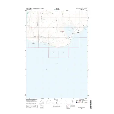
2014 Map of Beaver Island South
USGS Topo · Published 2014About this map
Beaver Island's southern coastline and interior wetlands are meticulously documented in this 2014 survey. The settlement of Nomad sits as a quiet hub near the eastern shore, while the inland Lake Geneserath dominates the landscape, connected to the coast by Cable Creek Rd and S Arm Rd. The geography here is defined by a series of distinct coastal features, from the western reaches of French Bay to the southern curve of Iron Ore Bay and Cable Bay. This map reveals a complex network of named trails and roads that crisscross the island's southern half, including Tetters Bus Trl and Betsy Smith Trl, which offer a glimpse into the local navigation and naming conventions of the modern era. Public land use is represented by the Beaver Island Public Beach, providing a clear point of reference for the island's shoreline character.
Find a feature on this map
29 named features on this map. Tap any name to fly to it.
Don’t see what you’re looking for? This feature index may not catch every label — zoom into the map to look around manually.
Map Details
Editions of this 2014 Beaver Island South Map
This is the sole edition of this map. No revisions or reprints were ever made.
Other maps of this area

1954 · Charlevoix
USGS Topo · 1:62,500

1955 · Cheboygan
USGS Topo · 1:250,000

1956 · Beaver Island
USGS Topo · 1:62,500

1958 · Cheboygan
USGS Topo · 1:250,000

1984 · Beaver Island
USGS Topo · 1:100,000

1984 · Charlevoix
USGS Topo · 1:100,000

1986 · High Island
USGS Topo · 1:24,000

1986 · Beaver Island North
USGS Topo · 1:24,000
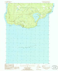
1986 · Beaver Island South
USGS Topo · 1:24,000

2011 · Beaver Island North OE E
USGS Topo · 1:24,000