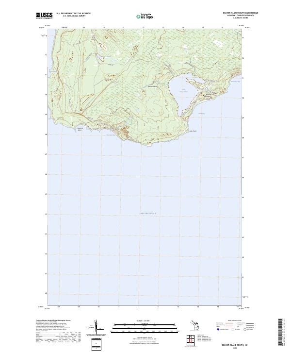
2023 Map of Beaver Island South
USGS Topo · Published 2023About this map
Beaver Island's southern coastline is defined by a series of prominent bays and points along the Lake Michigan shore. Inland, the topography centers on the significant freshwater reach of Lake Geneserath, which is buffered from the eastern coast by a network of local roads including E Side Dr and S Arm Rd. The interior landscape transitions from the wetlands of Millers Marsh to the drainage of Iron Ore Creek, which empties into the wide arc of Iron Ore Bay at the island's southern tip.
Find a feature on this map
28 named features on this map. Tap any name to fly to it.
Don’t see what you’re looking for? This feature index may not catch every label — zoom into the map to look around manually.
Map Details
Editions of this 2023 Beaver Island South Map
This is the sole edition of this map. No revisions or reprints were ever made.
Other maps of this area

1954 · Charlevoix
USGS Topo · 1:62,500

1955 · Cheboygan
USGS Topo · 1:250,000

1956 · Beaver Island
USGS Topo · 1:62,500

1958 · Cheboygan
USGS Topo · 1:250,000

1984 · Beaver Island
USGS Topo · 1:100,000

1984 · Charlevoix
USGS Topo · 1:100,000

1986 · High Island
USGS Topo · 1:24,000

1986 · Beaver Island North
USGS Topo · 1:24,000
1986 · Beaver Island South
USGS Topo · 1:24,000

2011 · Beaver Island North OE E
USGS Topo · 1:24,000