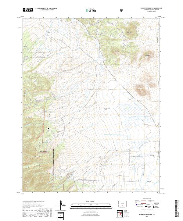
2022 Map of Beckwith Mountain
USGS Topo · Published 2022About this map
The Wet Mountain Valley dominates this 2022 survey, showcasing a complex irrigation network essential to the high-altitude ranching of Custer County. Settlers and engineers utilized several named waterways and diversions to manage the landscape, including the James Jarvis Swift Cr Ditch Number 3 and the Freer-Beckwith and Kennicott Ditch. The valley floor is framed by prominent peaks such as Beckwith Mtn and Grouse Mtn, with a portion of the San Isabel National Forest visible in the southwest corner.
Find a feature on this map
91 named features on this map. Tap any name to fly to it.
Don’t see what you’re looking for? This feature index may not catch every label — zoom into the map to look around manually.
Map Details
Editions of this 2022 Beckwith Mountain Map
This is the sole edition of this map. No revisions or reprints were ever made.
Other maps of this area

1889 · Canon City
USGS Topo · 1:125,000

1892 · Canon City
USGS Topo · 1:125,000

1954 · Pueblo
USGS Topo · 1:250,000

1955 · Westcliffe
USGS Topo · 1:24,000

1957 · Pueblo
USGS Topo · 1:250,000

1957 · Aldrich Gulch
USGS Topo · 1:24,000

1958 · Pueblo
USGS Topo · 1:250,000

1958 · Beckwith Mountain
USGS Topo · 1:24,000

1959 · Electric Peak
USGS Topo · 1:62,500
1959 · Horn Peak
USGS Topo · 1:24,000